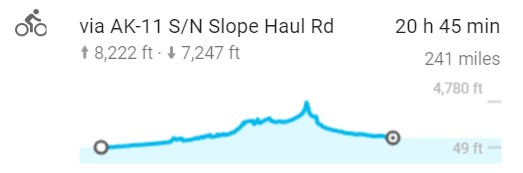
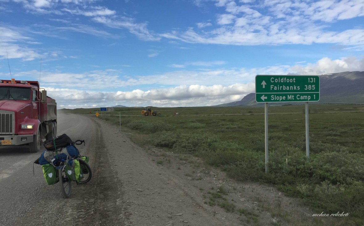
Deadhorse (Prudhoe bay) to Marion Creek/Coldfoot 390 kms


Day 1: Prudhoe Bay
 View of Yukon river as i flew from Fairbanks to Deadhorse


Brooks Range and the Trans Alaska Pipeline from the flight.
 Access to the Arctic Ocean (8 miles from Deadhorse camp) is possible only through the authorized tour operator, Deadhorse Camp, by paying 69 USD.
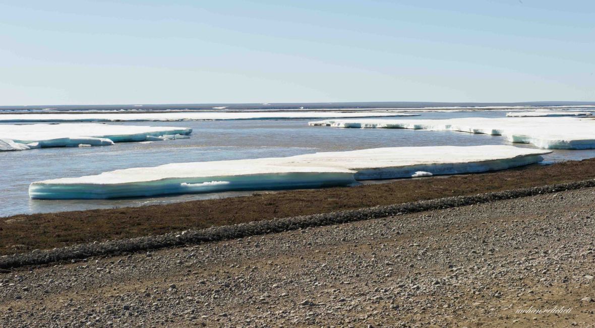
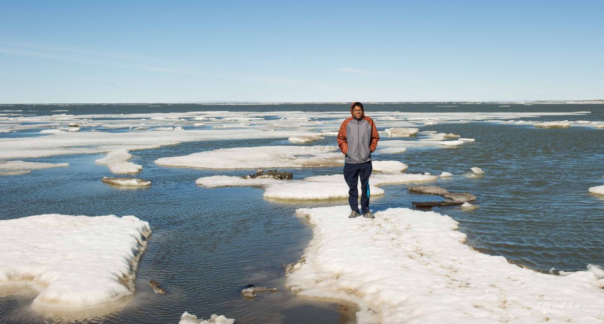 on the Arctic ice

 Logs floated from Mckenzie river (a grizzly bear is often spotted here).
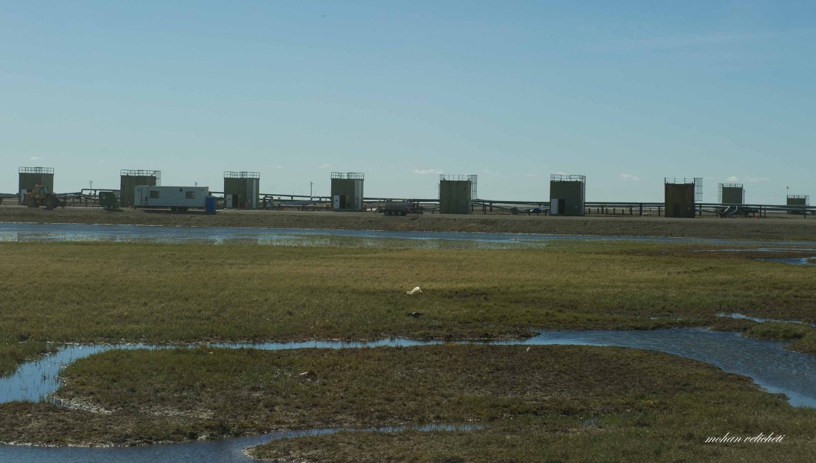 Wellheads in the Prudhoe bay oil field (largest oil field of USA, discovered in 1973)
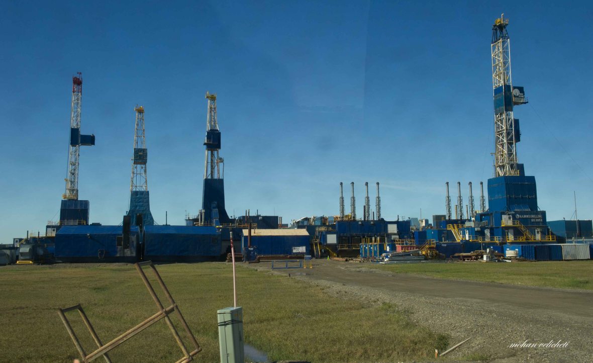 Rigs on standby (according to the tour guide, more than 500 people lost their jobs in the present crisis).


 Looks familiar

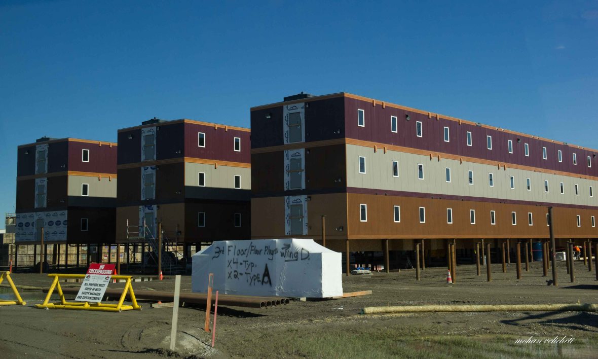 Camping facility for the oil field personnel
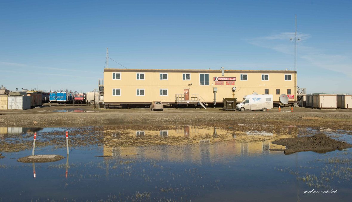 Deadhorse Camp (USD 219 per night), one of the 3 hotels in Prudhoe bay. Shaun, the manager picked me from the airport and offered space to fix by bike, and to arrange my luggage.
Returning from the arctic ocean tour, went to the only general store near the post office to buy a bear spray (=70 USD, 20 USD more than what it was at REI in New York).
 There is no formal campsite at Deadhorse. Shaun directed me to this gravel area beside the Sagavanirktok river, where one or two recreation vehicles camp informally. Tents are discouraged due to the presence of grizzly bears.
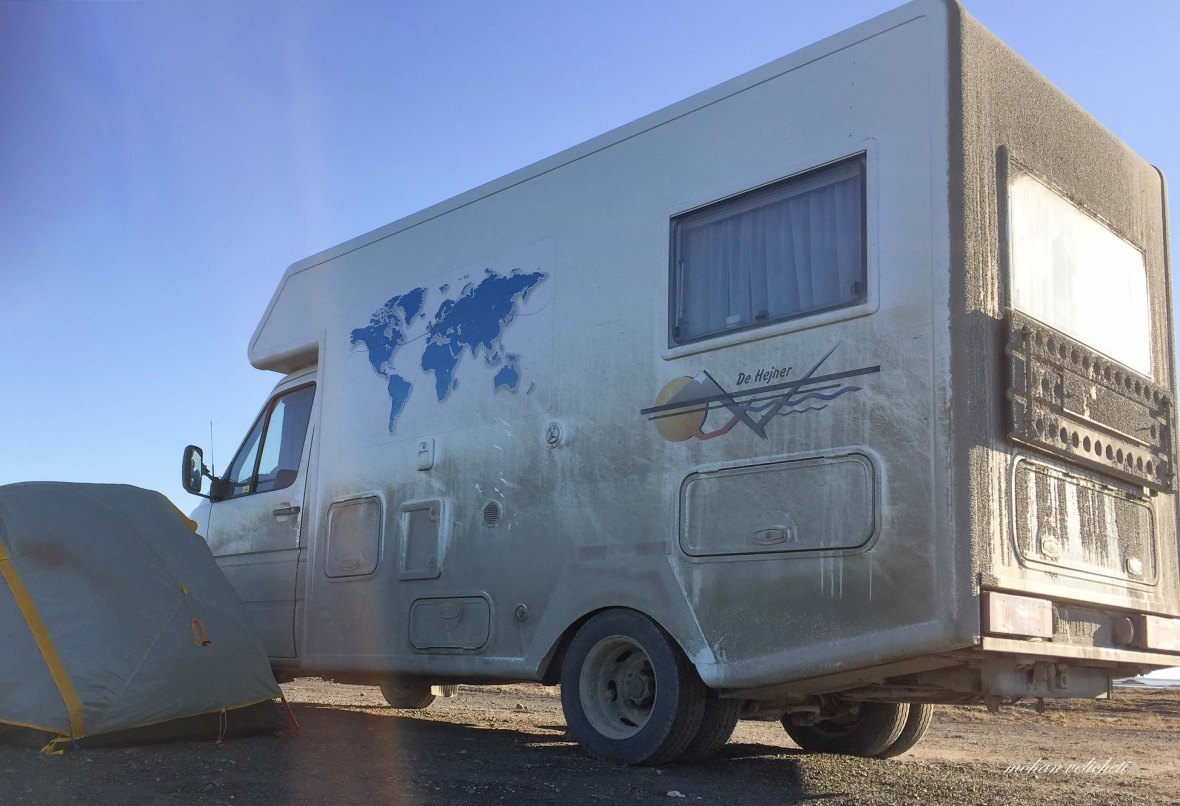 The German couple Detlef and Rosemarie repeatedly placed their RV to block my tent from the harsh wind. They are the most friendly Germans i have ever met. Tired and sleepless, slipped into my tent without the will to bother about the presence of grizzly bear.
 The mid night sun.
Day 2: Prudhoe Bay to Pump Station 2
Shivering in the cold wind, excited about the all night sun, i woke up and called Rajendra. Also texted Saroja to let them know the begining of my journey (cellphone reception is available in Deadhorse. The next reception is 800 kms away).
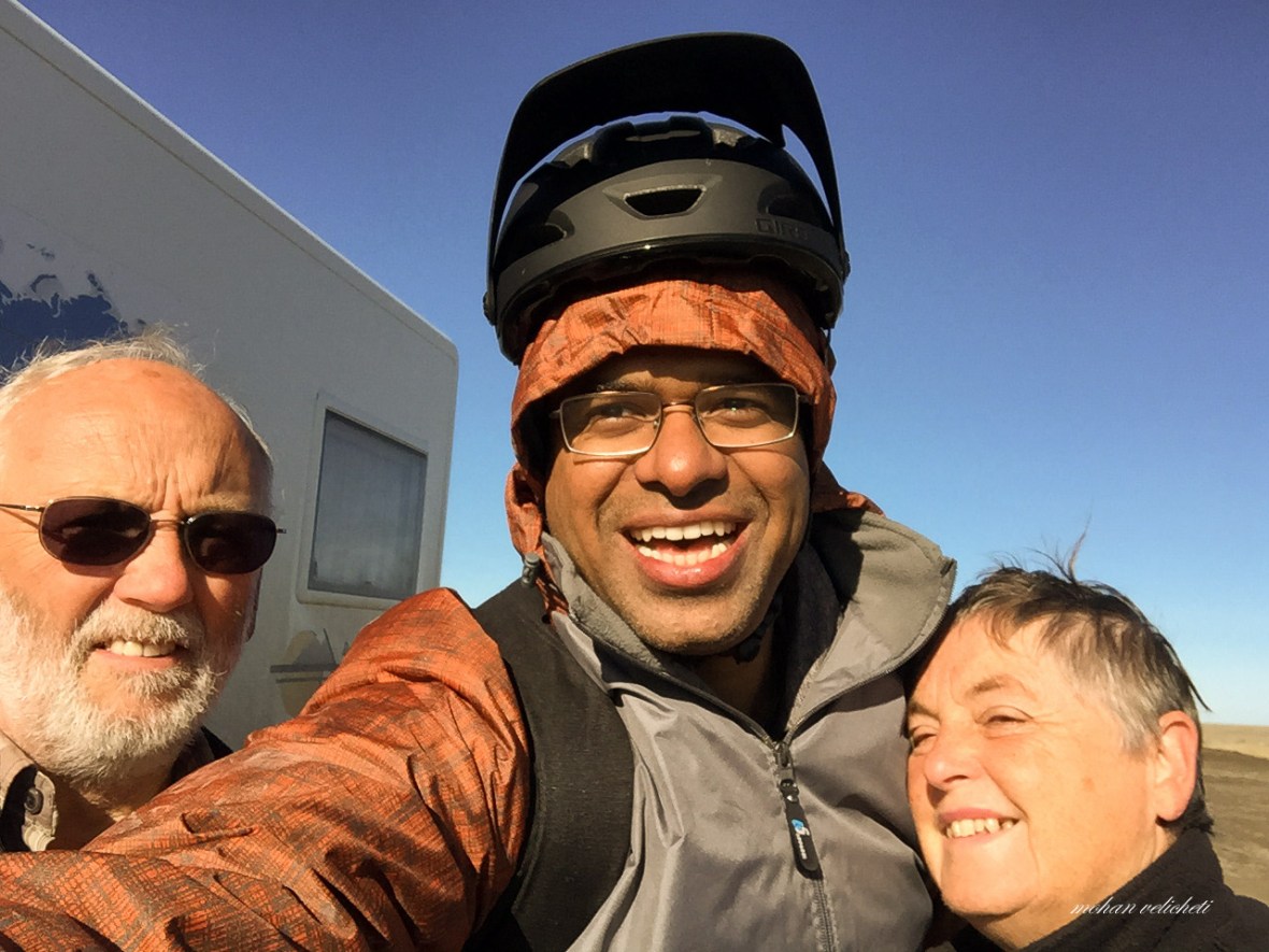 Could not thank these couple, Detlef and Rosemarie, enough, who were concerned about me. I carried too much luggage for a cyclist. They offered to drop some of my luggage in Marion Creek campground and some at Anchorage with Kate, the lady i met in the arctic tour bus.
 Rosemarie marking their 2016 trip from South to North America. They did previous trips across Europe (2012) and across Asia (2014).
 Services are few on the Dalton. Food and lodging is available only at Wiseman, Coldfoot (both around 400 kms from Deadhorse) and near Yukon river (580 kms). With this knowledge, I was caught up in the luggage chaos in the morning- what to pack and what to dump to reduce the riding weight.
With the help of Rosemarie and Detlef, finally, i hit the haul road (Dalton highway), which starts or ends at Deadhorse/Prudhoe bay on the Beaufort sea coast and runs southward to join the Elliott highway, 84 miles north of Fairbanks. The road follows the Trans Alaska pipeline, across the treeless North slope, over the Brooks range at Atigun Pass, and, up and downhill across the forested valleys. The road is the most remote, dangerous and challenging one. Surprisingly, considering the harsh winters, the Dalton is open all year and can be driven in winter as it is the only connection to the Prudhoe bay, the largest oilfield of USA. Over the next days, as i had seen, there were many inquisitive people driving the Dalton, stopping to help each others, if needed. The BLM (Bureau of Land Management) conveniently advises, “expect and prepare for all conditions. Prepare to be self-sufficient.”
 Ice in the Sag river that followed the road for few miles.
 Muck for the road maintenance. The thin line in the horizon are the Franklin bluffs.
The highway is named for James William Dalton, an arctic engineer involved in early oil exploration efforts on the North Slope. It was built as a haul road between the Yukon RIver and Prudhoe Bay during construction of the trans-Alaska pipeline, and was originally called the North Slope Haul Road.
 A triker, all the way from Virginia, waiting for our turn due to road maintenance. In 2014, heavy summer rains followed by extensive freezing in winter had trapped water in place, then a rapid thaw due to record warm temperatures in 2015 caused an unprecedented flooding, creating a lake around Deadhorse. Reconstruction of flood-damaged portions of the highway is in progress. It was new to me to see plastic foam insulation sheets being laid below the road to prevent thawing of the Permafrost.
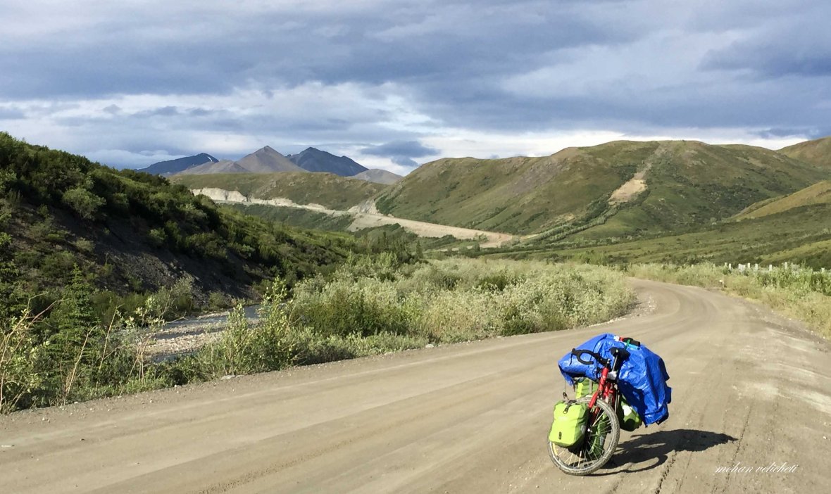
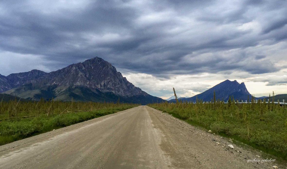
 Despite recent improvements, the Dalton remains about 75% gravel, with tire puncturing rocks, bumpy washboard, dust in dry weather, slippery mud in wet weather, and dangerous curves.The metal poles as seen on the left, mark the road edge, a great help in winter when blowing snow obscures the road.
 My camping on the first day beside the approach road to the pipeline.
Day 2: Pump Station-2 to Sleepy Mountain
 Pump station-2 on the pipeline. The 800 mile long pipeline between Prudhoe Bay and Valdez was constructed from April 1974 to June 1977 at a cost of $8 billion. The 48-inch diameter pipeline, of which slightly more than half is above ground, has 6 operating pump stations.
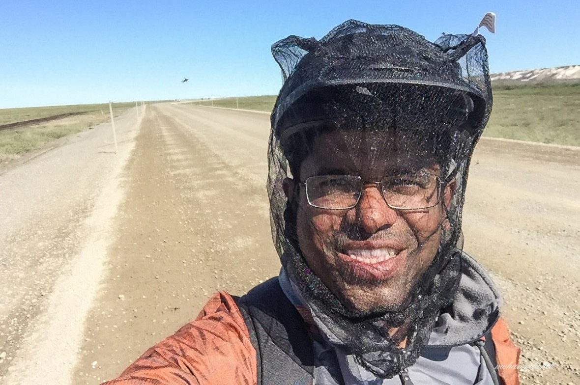 North slope tundra is home to millions of mosquitoes. Impossible to stand or ride without this head net.
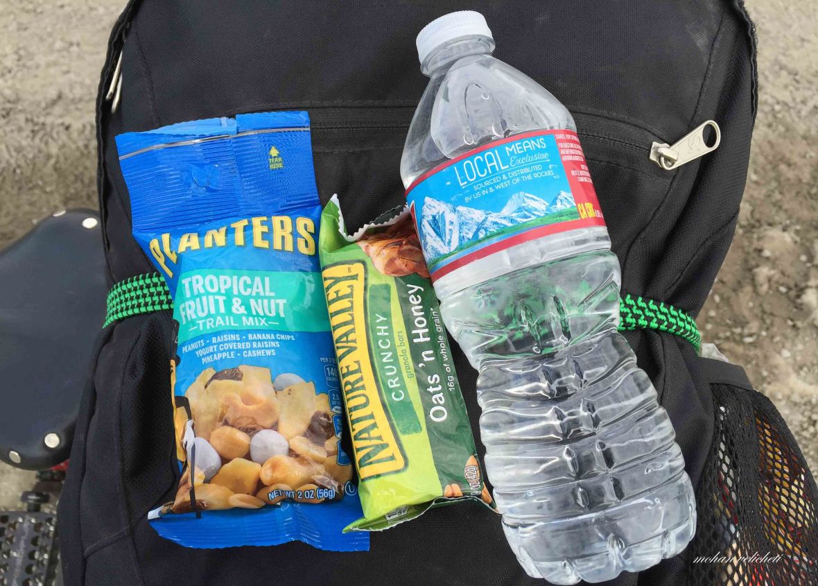
 Filling water from the road side creeks (of course filtering with Sawyer filter pouch). Carrying water adds weight and a filter is handy to a cyclist. There are many creeks to filter water from. I carried 3-one liter bottles.
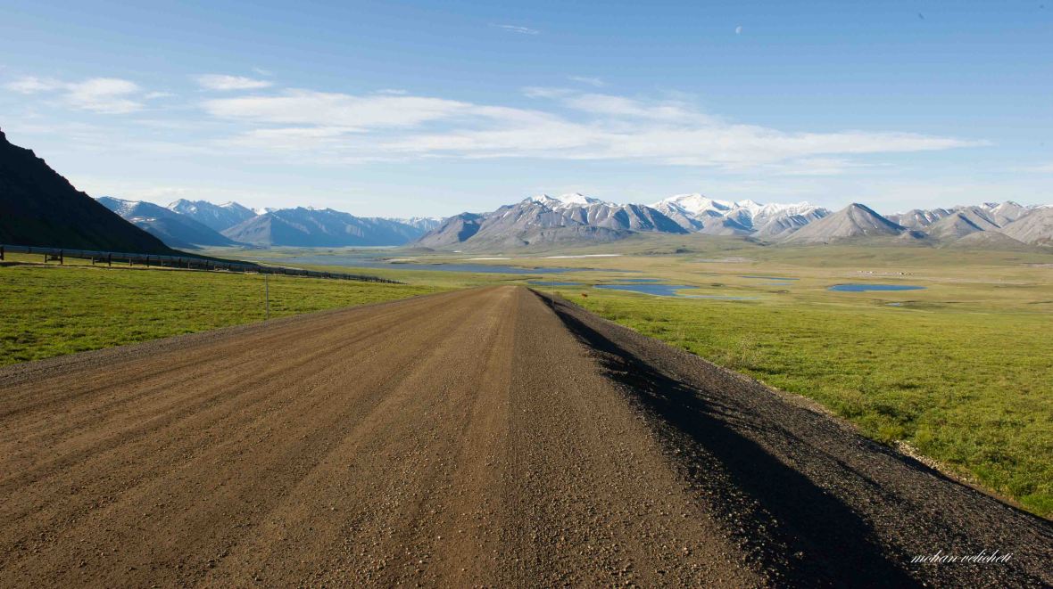
 The road continues on the tree less tundra. Around this high area, Porcupine and Central Arctic caribou herds migrate on their way to and from their calving grounds.
 Two polish cyclists, cycling from Fairbanks to Deadhorse.
 The sagwon bluffs.
 A note on the tundra displayed at the observation deck of Sagwon bluffs.
 The heavy trucks on the haul road splash sand and gravel which blind the cyclists with a cloud of dust.
 Interesting name. Also, these steep, blind hills demand the CB radio users to call out ahead of the curve.
 Musk Ox beside the road near pump station 3.
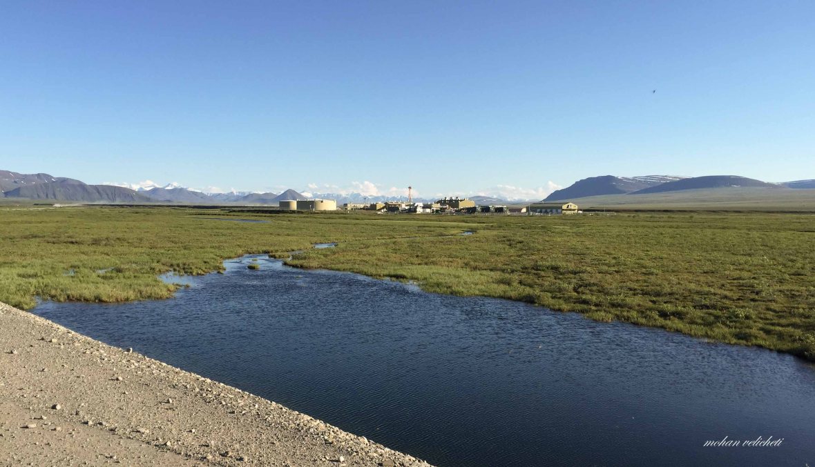 Pump station 3 from Oksrukukuyik creek.
 Midnight sun as i camped on Day 2 near the sleepy mountain.
 Midnight sun through the mosquito net.
 Ready with bear spray and a knife, in case a bear attacks.
 Living with Mosquitoes.
Day 3: Sleepy Mountain to Galbraith Lake
 Ready on Day 3 as communication fiber cable guys worked beside the road.
 As i was contemplating about the distance to go on the day, this truck stopped beside me.
 Out came a hand with these.
 Happy to receive these. (My first experience of generosity).
 Meanders beside the road.
 View of Brooks range as i moved on.
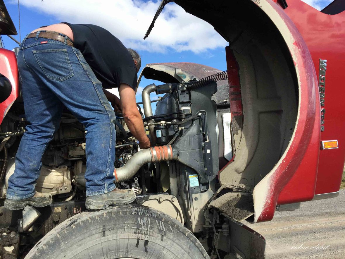 A cyclist helping a trucker. How about it. This guy wanted a knife to cut and fix a hose, and, I had the knife. His 1000 mile journey continued happily. Now, the second act of generosity on the same day- he gave a pack of beef jerkey. Couldn’t tell him that i dont eat beef, and accepted the packet.
 The arctic ecology research station of the University of Alaska, at Toolik lake. Reminded me of my research days. Wanted to talk with a scientist. But, as visitors are not allowed, just watched from the turnoff for somebody to show up. The mail box at the turnoff was marked “Magazines Please.” Out of curiosity, i opened it.
 Ha ha… here is the bonanza. Chocolates. Third act of kindness, this time from an institute.
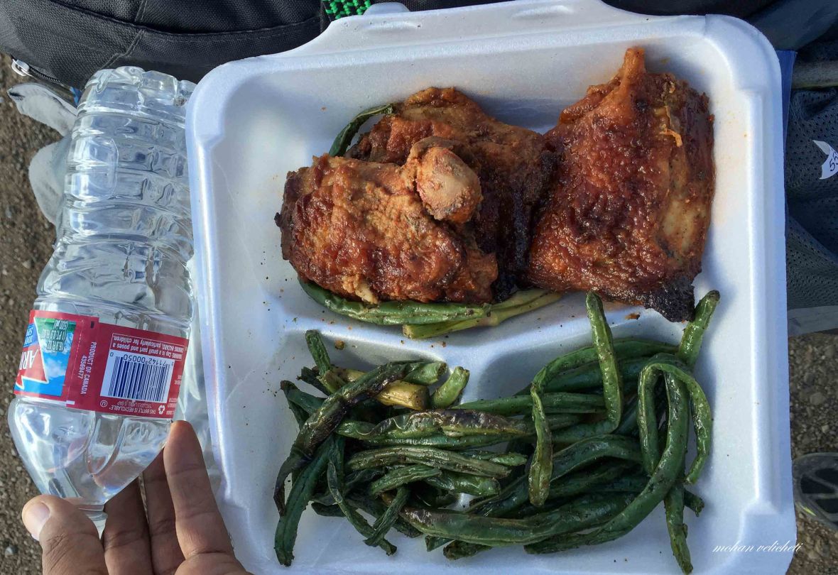 As i moved on, a pick up vehicle overtook and stopped ahead me. Came out the same man from the morning truck, “hey, my friend from Bangaluru, here is your lunch”. Wahv… can’t ask for more kindness.
 This gentleman pointed to the hills. “Next to the hill is my camp. My father belongs to this area and my mother is from New Jersey”.
 Tried to take shelter under the pipeline in the downpour.
 As the rain still continued, i covered myself with sleeping bag under the tarp at this pipeline, just 1 mile short of Galbraith lake.
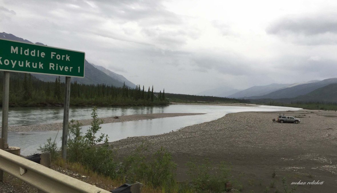
Day 4: Galbraith lake to Middle Fork Koyukuk River 1 (Wiseman turnout)
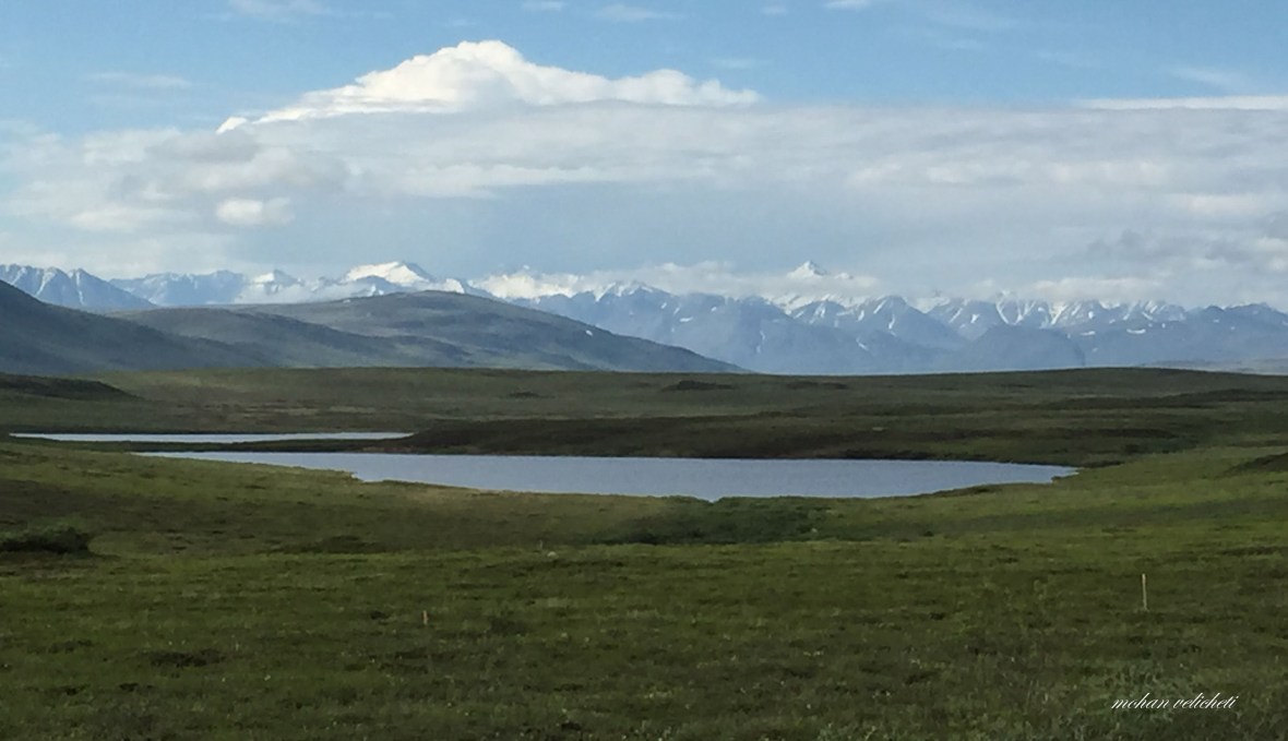
 As i woke up the next day, clear view of the Brooks range reminded me of the tough day ahead. Nevertheless, excited about the beauty of the mountains iam about to go through.
 Galbraith lake. It is a remnant of a huge glacial lake that filled the valley in the last ice age. It was named by USGS geologists in 1951 for Bart Galbraith, a bush pilot who was lost while flying in the area. The Campground as seen on the distant right is in a wide tundra-covered valley ringed by mountains.
 Series of lakes at Galbraith.
 Pump station 4 on a hillock. This station has the highest elevation of all the pipeline stations (2760 feet). It is also the launching and receiving station for special measuring and cleaning devices called “pigs”.

 At the beginning of the trail that leads to a Roche Mountonnee (French name for the glacial erosion landform).
 Ride with beautiful vistas. By the way, it takes about a week for oil in pipeline to flow 800 miles from Prudhoe bay to Valdez.
 Indian Roti for lunch at a creek. Lots of arctic ground squirrels alerted me for possible presence of bears. Bears like them for a snack.
 The view doesn’t change as i rode miles and miles.

 Hiding from rain in a river drainage pipe under the road.
 one of those cute small cars of the construction workers as i ascend the Atigun pass.
 Deceptive board, located at the bottom of the Pass. Thought that i made it. But the 12 deg slope in the next 2 miles took me to the actual high point of the pass.
Atigun Pass (4800 feet) in Brooks Range, is the highest pass: Continental Divide.
 Looking down into North Slope road as i ascend.
 A generous tourist asked if i needed a lift to the top of the Pass. “No, thank You, i want to test my mental strength”. Appreciating my answer, she gave these grapes. Well earned delicious grapes.
 A Wyoming gauge at the top of Atigun pass. The North Slope receives about 5 inches of rainfall annually, although the permafrost prevents the water from being absorbed by the soil. The pipeline is buried in the narrow deep valley far below the highway with insulated concrete cribbing to protect it from rock slides and avalanches, and to keep the ground from thawing.
 A typical cirque (an amphitheater-shaped depression caused by glacial erosion, majestically sitting right at the top of Atigun Pass.
 At the top of the Atigun Pass, view from the Cirque. Often, Dall sheep are seen on the road as they come to lick the calcium chloride put on the roads for dust reduction.
 Solifluction lobes as i descend southwards from Atigun Pass towards Chandalar River bridge. These scalloped waves of soil on the hill side are formed when meltwater saturates the thawed surface soil and flows down the hill.
 A quick descent from Chandler shelf, into Dietrich valley.
 A board marking the beginning of North slope administrative Borough (the world’s largest municipality in land area), the largest one. Unlike the rest of the US, which is organized into counties, Alaska’s unit of regional government is the borough.
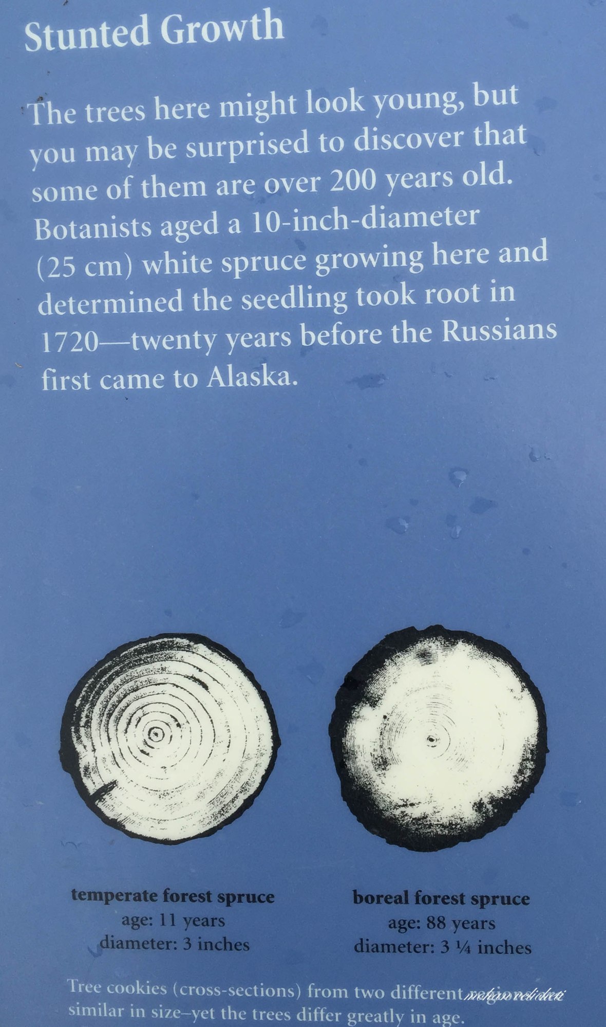
 After descending the Chandler shelf, the rain stopped, sun appeared, administrative district changed, tundra gave into spruce forest. Felt so glad to see the post card Alaska topography. The interpretive panels were quite informative.


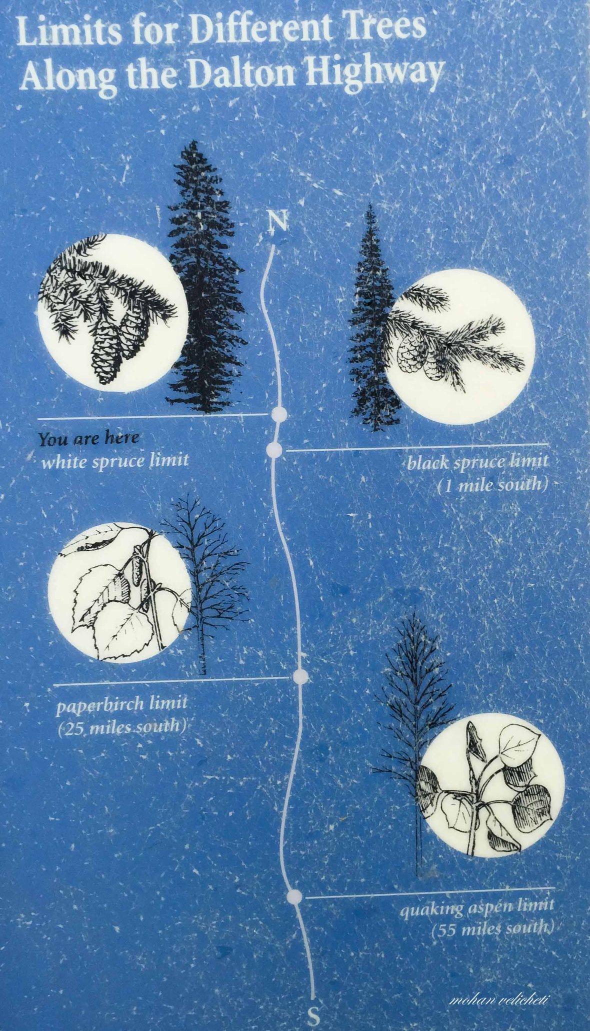 Some facts on tundra and vegetation.
 Near Snowden Mountain. Having ridden 80 miles already, tired to shoot photos along the wilderness vistas- river valleys, quiet forest valleys and spectacular mountains.
 Dillon mountain on the left (shot around mid night) is a limestone mountain named after J T Dillon, an Alaskan geologist who spent his life studying the Brooks Range.
 hmmm…Who can better appreciate this than an Indian?
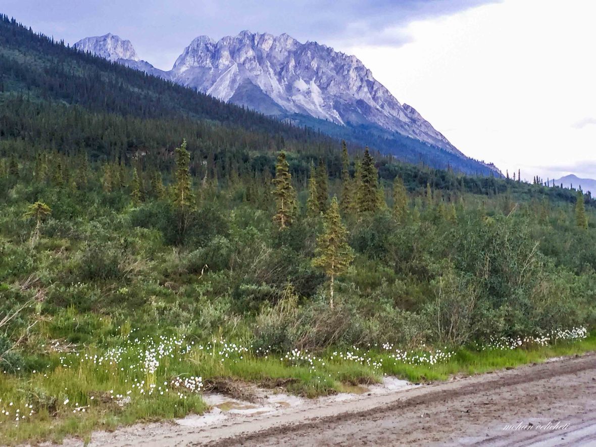
 Sukakpak Mountain with exposure of copper and cinnabar veins. This mountain is sometimes said to mark the traditional boundary between Eskimo and Athabascan Indian territories.

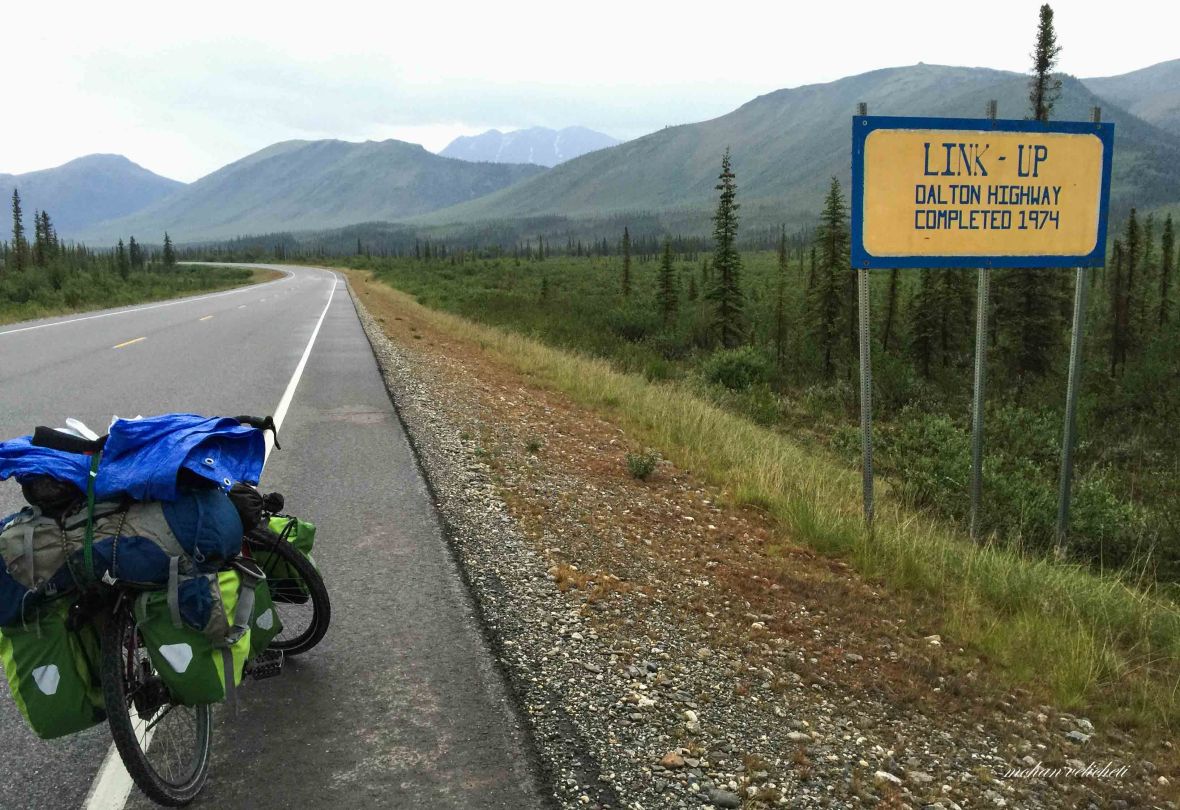 Link Up, where 2 sections of road constructed by different crews were joined when the Dalton highway was completed in 1974. Gold mining area in the streams around here. The largest gold nuggets ever found in Alaska were found in Hammond river, next to this.

 Could not ride any more. Seeing a car camping, retired for the night.
Day 5: Wiseman turnout to Marion Creek
 Woke up to a clouded day. Just before noon, saw the two families i met on Atigun Pass the previous day, driving from Wiseman. Their cheerful wishes energized me to start the day. For a while, caught up in the dilemma whether to visit Wiseman or not?
Wiseman is an active mining town for gold. There are 3 B&B to stay, a museum and several historic buildings. And, Wiseman is one of the best areas to watch the aurora borealis with near guaranteed, exceptional viewing as the books say, on both equinoxes.
 Ride to Marion creek expecting to receive my food that Detlef and Rosemarie had possibly left with the campground host.
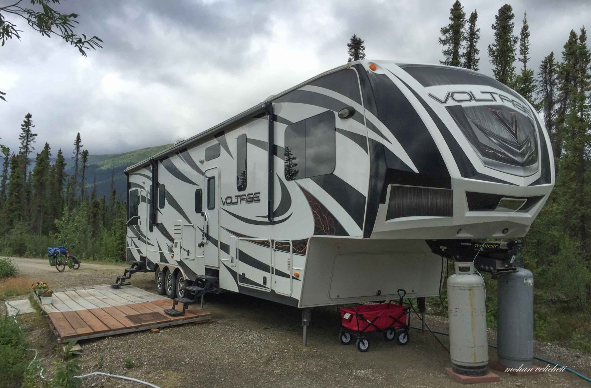 The mobile truck house of the Camp host at Marion Creek (“meet the farthest north public campground host in America”).
A turnoff, easy to be missed by speeding vehicle, led to the Marion Creek campground. Not familiar with how to check in the campgound, rode around and waited for the host to show up. But on another look around, realized that i have to self check-in.
 Self check-in, my first experience of staying in an US Campground.
 Bear proof food lockers.
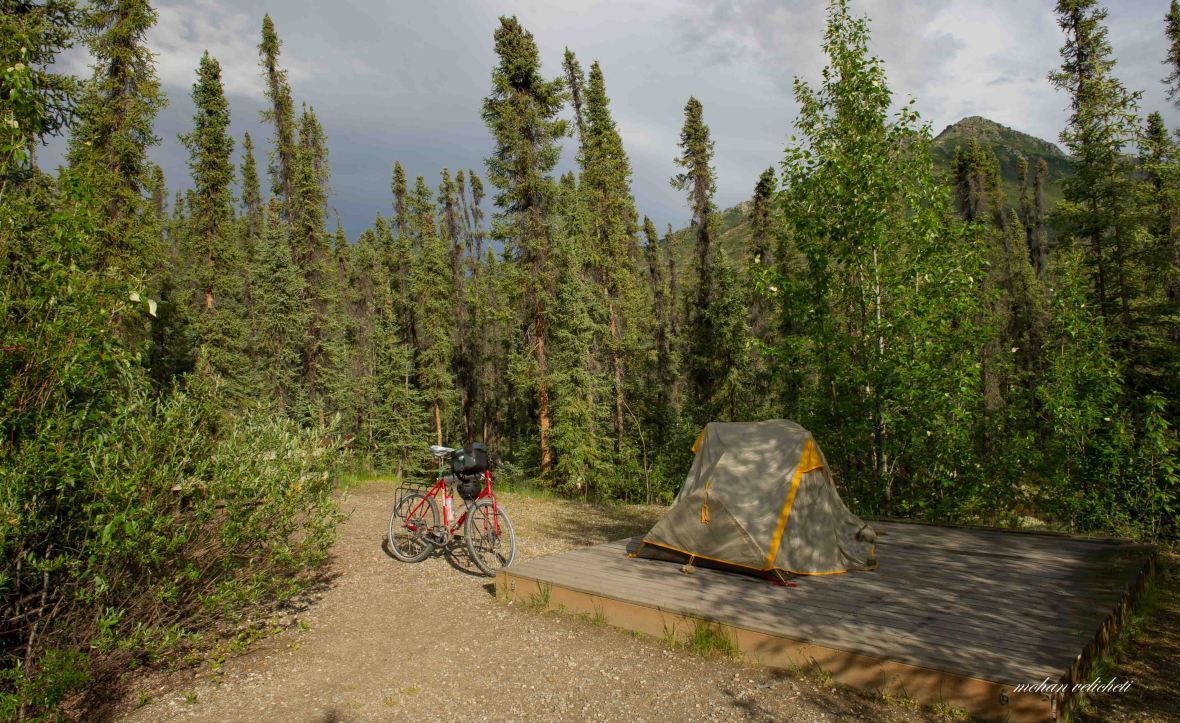 My campsite at Marion Creek.
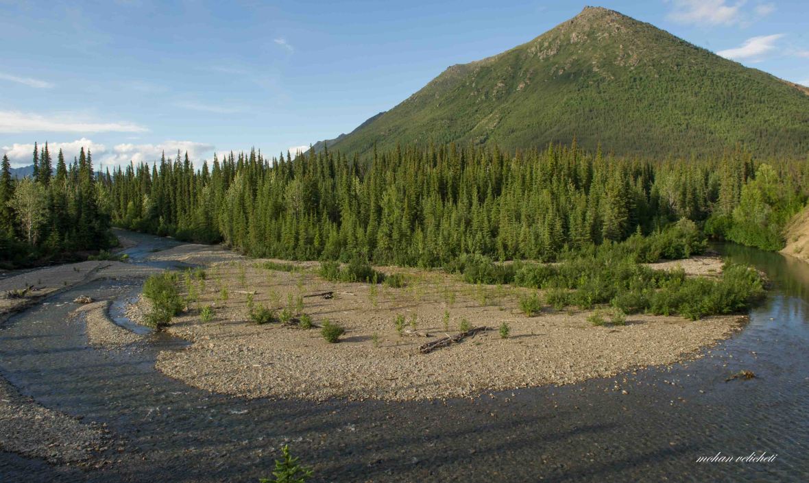 Marion creek, a meander few meters away from my tent.
 Tundra as i walked beside the camp.
 a close-up view of the tundra vegetation
 Chris, a Transportation and Planning engineer with the US Public Works, from Eugene, Oregon had joined me (riding all the way from Eugene to Deadhorse and back in his BMW bike). Had a great time talking with him on diverse topics. Here, we were appreciating the midnight sun rays on the mountain behind us.
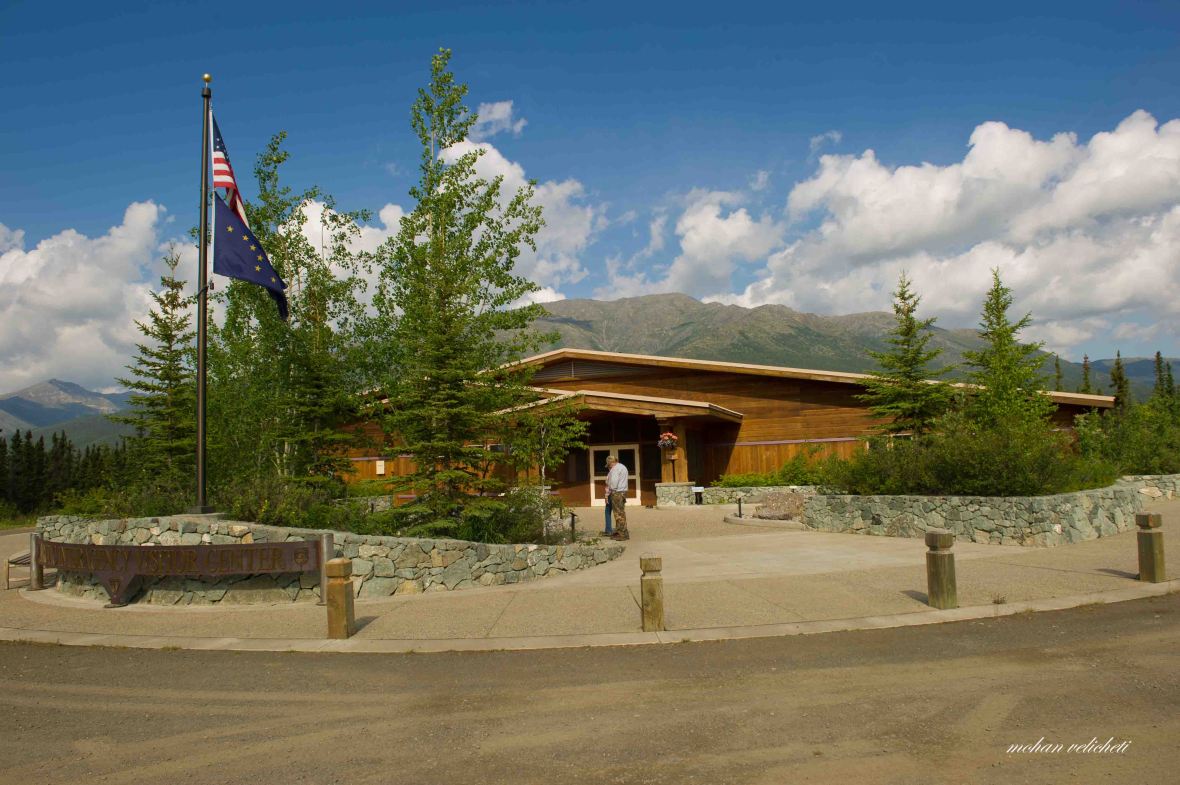 At the award winning arctic visitor center in Coldfoot, a must stop for visitors. It has nice educative and informative exhibits. Its a haven for the weary travelers.
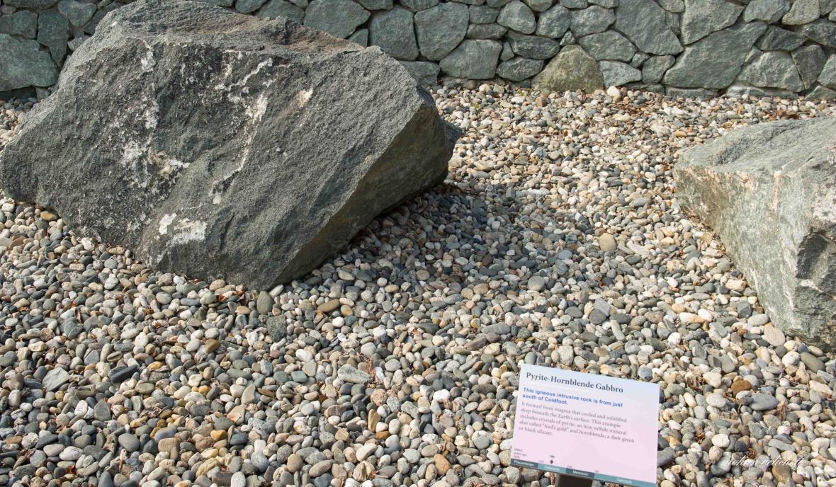
 Impressive boulder displays of native rocks.


 Marking my foot print on Mysore, India. The fifth Indian of the season. I guess the other 4 must be Indians from the US.
 The USPO at Coldfoot. A post office was established here in 1902, when Coldfoot consisted of “1 gmabling hole, 2 roadhouses, 2 stores and 7 saloons.”
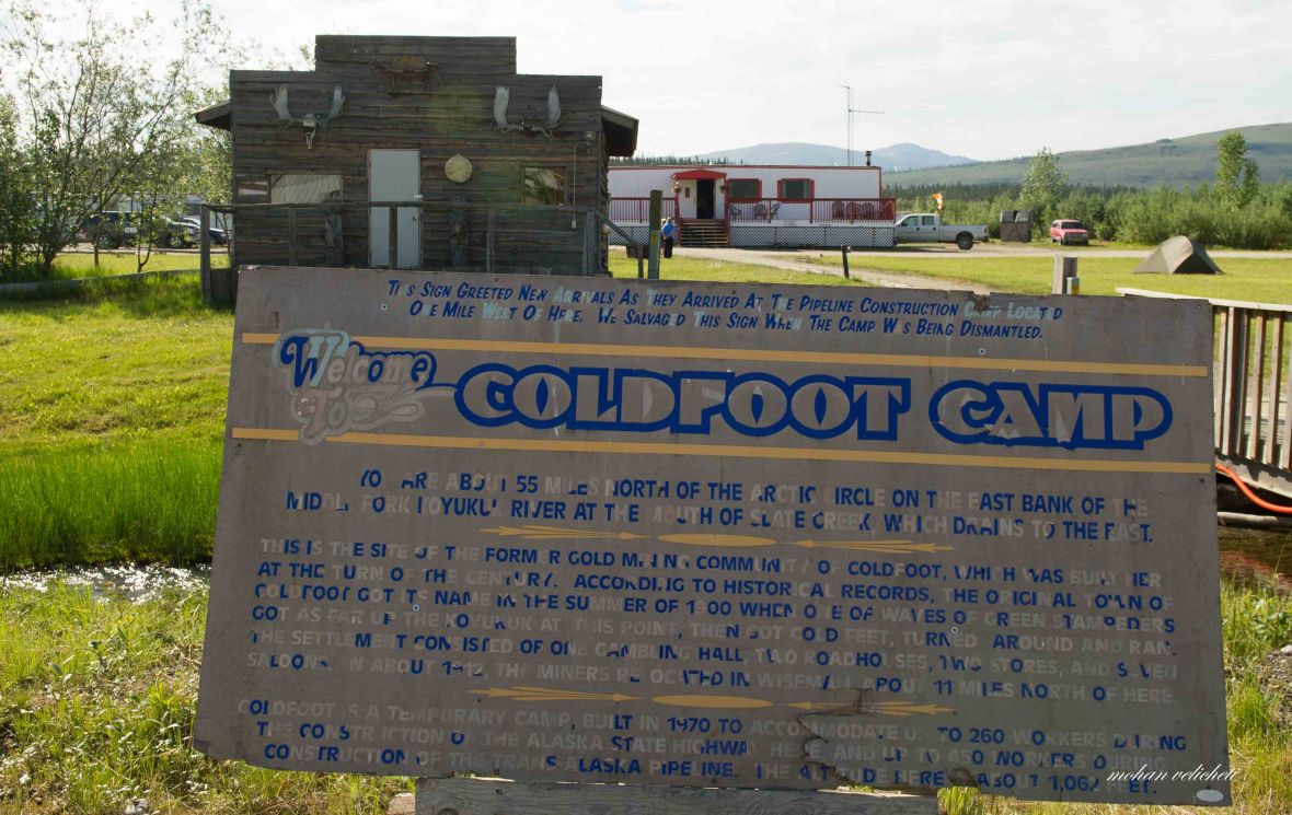 The old miner’s building. Coldfoot got its name in 1930s by green stampeders who mapped the area around, then got cold feet and turned around and departed. Another boom happened in 1970s when it became the construction camps for the Trans-Alaska pipeline. In 1995, when the highway was opened to the public, all the way to Deadhorse, Coldfoot became an important service stop.
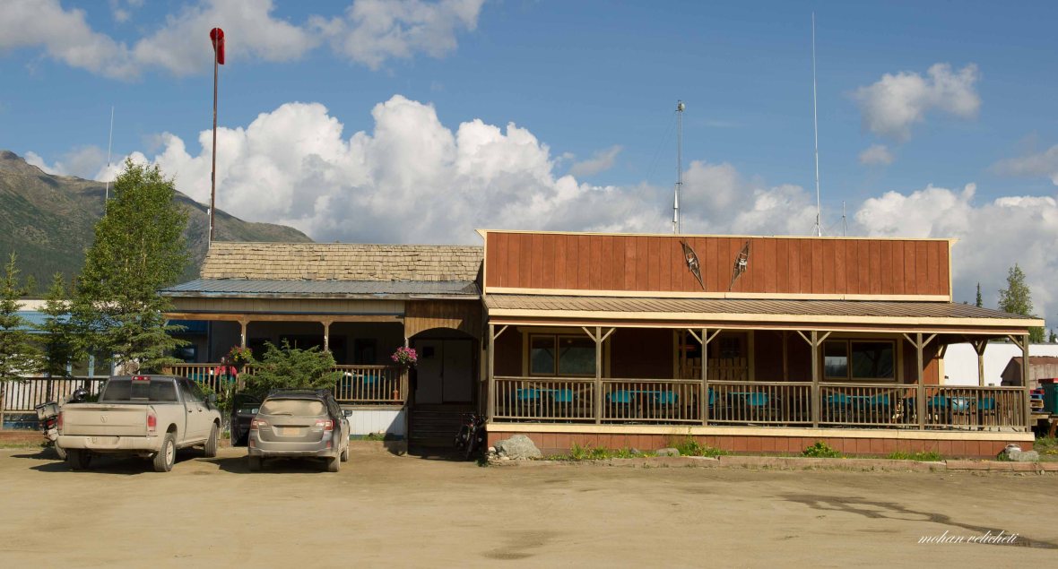 Trucker’s cafe, the only cafe between Deadhorse and Yukon river.
 Inside the cafe. The log behind the counter displays personal messages for travelers. The cafe is a kind of one stop solution for everything you need. Be it information, lodging, fuel, food, news of the highway or the gossip of the region.
 Missed these buffets, but not the free coffee.
 Decided to take one day break and spent the day with Muriel and Terry.
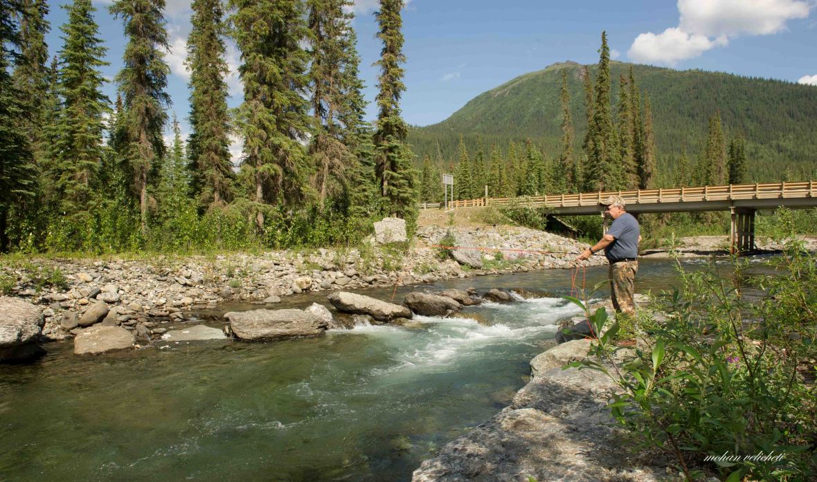 Terry teaching me how to fly fish.
 Coincidentally, it was 47th anniversary of Muriel and Terry. Felt glad to be with them that day.
 As they both are vegetarians, Muriel cooked for me the greyling Terry had fished.
 the free firewood at Marion Creek campground.
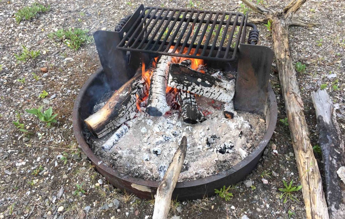 We three, having a pleasant evening with campfire.

Meticulous .. Vivid description . Good luck !! Great adventure too begins with the first step !!
LikeLike
Fascinating! Thanks for taking the time to write up your trip.
LikeLike