


“Sure it gets a little rough at sixty below. Your brakes freeze to the drums, or you can pop a drive shaft like a piece of candy cane if you’are not kind of tender with the gears. Make a wrong move on a hill, and suddenly you’re driving an eighteen-wheel toboggan. That’s how come some guys call this road the Kamikaze Trail. But it’s the best trucking in the world if you know what your’re doing.” –an unknown source on the Dalton highway.
Day 6: Coldfoot to Arctic Circle
After a day’s rest at the serene Marion creek campground with Muriel and Terry, I wanted to start the morning ride with a sumptuous breakfast buffet at the Trucker’s cafe in Coldfoot. But, i was too comfortable to leave the camp. Finally, I bid good bye to the couple and rode the 5 miles to Coldfoot camp, with a wishful thinking that the buffet will be served even at 09:30 hours. At the entrance of the cafe, I met Shaun (chasingthesunrise.org), the English cyclist, whom i saw the previous day while fishing at the Marion creek.
 Shaun from England, the strong, athletic, friendly guy with loads of patience, with whom i rode from Coldfoot to Denali. He turned out to be a disciplined cook serving hot breakfast and dinners over the next few days.
We both started the ride around noon. After riding two miles, i realized that i had dropped my bike gloves on the way. While cleaning the bicycle at Coldfoot, i kept them on the backpack on the back rack. It is easy to miss the unattached things on a bicycle ride. Not willing to go back the two miles, i continued to ride forward. Soon, while i was appreciating the view of Cathedral mountain to my right and Twelve mile Mountain to the left, realized that a truck coming from behind slowed down. The driver waved my glove. I nodded and he threw it from the window, and accelerated his way. Looks like he found only one, the right hand glove, which was later found to be very handy to push the heavy bike uphill.
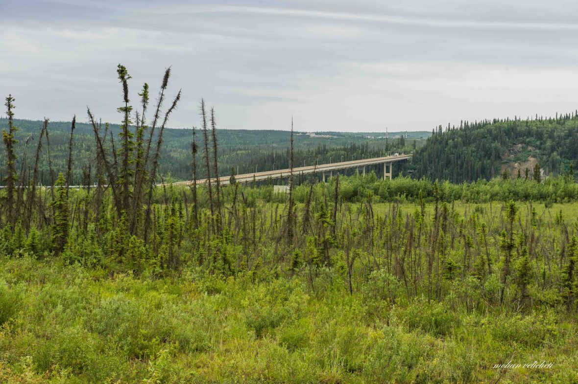
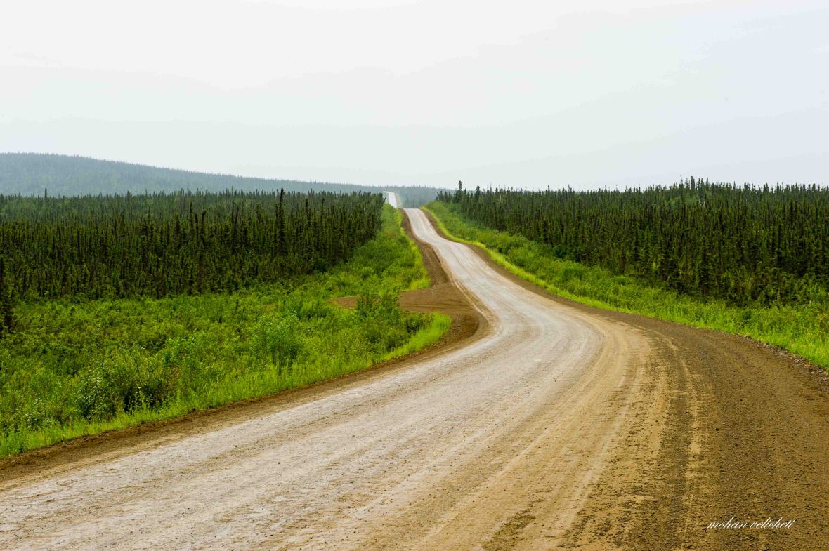
The scenic views continued as the pipeline played hide and seek with the road as it passed over the foothills of Brooks range. Once in a while, a restricted side road led to active private mining areas.

After crossing the South Fork Koyukuk river, Shaun and I noticed a brown thing standing or walking on the road at a distance. “It could be a brown bear,” I said. On closer look, Shaun said, “looks like a human.” As we approached, we indeed saw a human being walking towards us. Surprised to see such an activity on the road in this no man’s land. It was Franchesco.
 Franchesco, from Italy, is walking all the way from Anchorage to Prudhoe bay. Surprised to hear that he threw away his Gopro in the trash bin at the hotspot cafe at Yukon.
 While we still talked with Franchesco, Chris stopped by on his way back from Deadhorse. Felt nice to see him again, but also felt sad that i cannot camp with him once again to have an educated conversation like the one we had the other evening.
 Further down south, the Greyling lake wayside had a beautiful view of the lake and the pipe line. It had an interpretive display on early hunters in the area. On its advice, we looked around keenly on the lake shores for ducks, bears and moose. Couldn’t find any though.
As we rode further, we crossed the Jim River. An interpretive display stated how king and chum salmon swim from the Bering Sea, 1040 miles against swift currents to arrive at the Jim River to spawn.
 Pump station-5, which is not actually a pump station, is a “drain down” or pressure relief station to slow the gravity fed flow of oil descending from Atigun Pass in the Brooks Range. The glacial moraine marks the southern boundary of Brooks Range glaciers during the most recent ice age. Not far from here, on the turn out to east, is the Prospect Camp, which holds the record for lowest officially recorded temperature in Alaska, -62 deg C on Jan 23, 1971.
With the steep Gobblers Knob ahead, i told Shaun to roll on at his pace to find a camp at the arctic circle. By now i started feeling bad for reducing his speed. The observation deck at the top of Gobblers had interpretative panels about haul road construction (the last 358 miles of road were completed in just 154 days).
The road descended about 2 miles from here, one of the first long steep downhills. At the turn, was a sign “Oh Sh-t Corner.” Many truckers have lost their loads coming around this sloping curve too fast. By now, i gave up breaking during downhill,s wishing that there should not be any pot holes. Shaun hit a speed of 49 mph while i got about 44 mph.
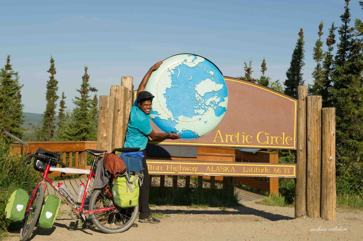 A dream fulfilled- at the arctic circle (remembered my moments at the equator in Ecuador and Kenya, and Tropic of Cancer in India).
The arctic circle sign with the big blue earth, as in the picture, is located on a loop road to the west of the Dalton, with a well maintained BLM wayside with picnic tables in the woods, grills, pit toilets, litter barrels and interpretive display on the observation deck. When i reached there, a native Alaskan family from Fairbanks were having their merry time. I obliged to their request to click a group photograph. The young man among them was on his own, doing his marshal art tricks on the observation deck, while his sister took his action photos. After their photo time, they returned back to Fairbanks that evening, which left me surprised that they have come all the way north but not traveling to Prudhoe bay.
According to the information board, the sun does not set on summer solstice (June 20 or 21) and does not rise on winter solstice (December 21 or 22). A third of Alaska lies within the Arctic Circle, the only true polar region in the state.
From the wayside, it was another 0.5 mile uphill to the camping area, which is still under development. It had some picnic tables, a pit toilet and bear proof garbage containers. It was a good camping ground for no fee. Later, i was told that many people come to camp here so that they can say “we spent the night on the Arctic Circle!” We settled for camping with two motor bikers from Sweden on one side, and 8 post doctoral researchers on Bumble bees, from the University of California on the other side. Recalled my own research interests on interacting with the researchers.
Shaun cooked rice and lentils while I warmed the MTR bendi masala with the water offered by an elderly couple in RV. We had a delicious meal around 10 pm while more RVs and cars poured into the camp.
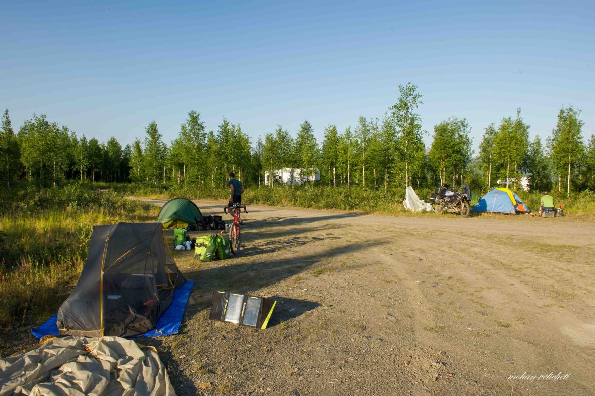 At the Arctic circle campsite
Day 7: Arctic Circle to Hot spot cafe near Yukon River
By now, i got used to the daily chores in the morning. Waking up, make breakfast, pack the tent, check around if leaving any traces, say good bye to fellow campers (if at all anyone is lazier than me), and hit the saddle. The company of Shaun made a difference. Even before i woke up, he made breakfast for both of us. So, the next few days, i haven’t touched my stove, a nice bonus to a lazy rider like me.
Also, riding the 1 to 2-mile long 9-10% uphill gradients, zooming down nearly the same length of downhill with speeds of 35-45 mph, filtering water from the creeks, making eye contact with each and every vehicle traveling in the opposite direction to exchange quarter to half smiles and many wishes, dust and fine gravel on the face, spruce forests, fire-weeds beside the road etc., have become part of daily life.
The vegetation occasionally changed to alpine tundra. Lichens and white mountain avens dominated the well-drained rocky ridges, while the more saturated soils along side the road were covered by dense stands of dwarf shrubs.
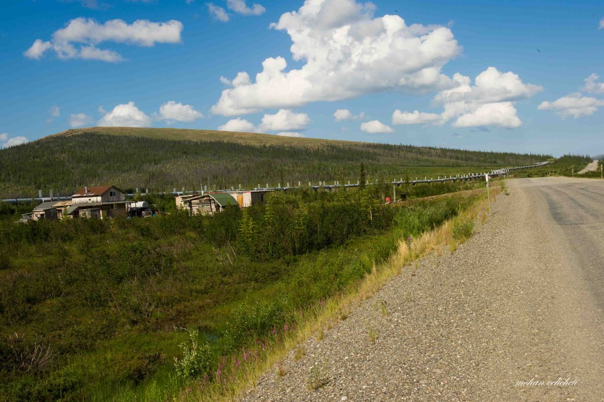 a cluster of buildings (may be, the first private property seen on the road between here and Deadhorse).
 At finger mountain (a tor), met this Japanese guy cycling from Anchorage to Prudhoe Bay. From him, i got the name of Dhruv Bogra, the other cyclist from India, 2 days ahead of me, about whom i heard from many people on the way. (Lost this guys name as i lost my iphone notes. Somebody may pl educate me as to how to use an iphone).
 This guy and his colleague from the US airforce, walked alternatively for a fund raising campaign. Though i couldn’t comprehend what that is, felt nice to see somebody walking.
 Along zig zag pipeline. Travelling the Dalton educates one, or plants a seed of inquisitiveness, about the mid-stream (pipelines) of the oil industry. For eg., here, the zig zag design allows the pipeline to flex, accommodating temperature changes. There are occasional valves over the buried pipeline which are radio-conditioned to shut down the oil flow when necessary.
 Could not escape from the localized showers. Missed a great photo opportunity of the Tors (=high, isolated pinnacles of jointed granite jutting up from the tundra), a residual feature of erosion.

 Stunted, low growing black spruce (indicating permafrost near the surface, or poorly drained soil, at the beginning of the section of the road dubbed as “Roller Coaster” (steep descents followed by steep ascents).
 At the BLM campground near hotspot cafe (behind the trees). Not willing to cook dinner, had a big chicken burger at the cafe. Missed taking pictures of the nicely done gardens with a different attitude. Beside food, it had rooms and a gift shop. The camp is conveniently located near an artesian well.

In the absence of bear proof food storage boxes, Shaun followed the standard way of hanging the food from a tree.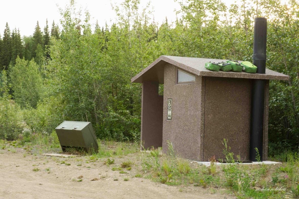 As i had food in all four panniers, found my way of saving the food from bears- kept on the roof of the toilet.
Before going to bed, we could not resist the idea of searching the trash for the GoPro, which Franchesco threw away four days ago. Also, met the gentleman from Spain to practice a bit of Spanish. He shared his experiences of Katmai peninsula, the valley of ten thousand smokes and the Brooks lodge which has platforms to watch bears catching migrating salmon. On my exclamatory reactions to the costs, he repeated the phrase, “Alaska, una vez en la vida.” With his stories rewinding in mind, i told to myself, “some other time, quando tengo dinero.”
Day 8: Hot Spot Cafe to Livengood
 A good reminder for travelers to stop for gas at Yukon River camp, located after the turn.
 Breakfast at Yukon River Camp, and a lazy start under the clouds. Located on the bank of Yukon, it had a lodge, fuel, gift shop and extensive menu with facility of packed lunch.
Here, i met few tourists on their way to Deadhorse in a bus. At least one agency runs a bus from Fairbanks to Deadhorse for tourists. Food, transport and stay at Deadhorse is included in the package (don’t know how much! though somebody said that it is USD 250 one way). Felt the luxury as breakfast boxes were handed to them as they entered the restaurant.
I quickly sneaked into the showers located inside the restroom area. The paid showers displayed “not functioning.” But, on seeing hot water flowing at the turn of the knob, I quickly showered and walked out happily.
 Another geographic landmark achieved, viewing and being at the Yukon river, the longest river in Alaska (1979 miles from Canada to Bering Sea).
Met Terry and Muriel (from my day at Marion Creek), who are on their way back from Deadhorse. They collected sands from the major rivers they visited, for a paraplegic girl back in their town in Vermont. What a nice gesture?
 Water and air are the only transport mode to the interior communities in Alaska. Here, a boat being loaded.
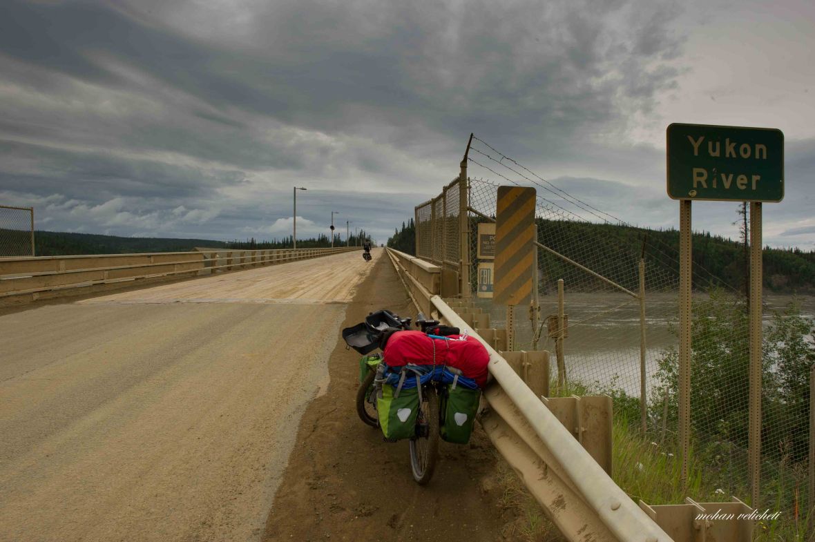 The 2290 feet long wood decked bridge has a 6% grade. Completed in 1975 (upgraded in 1999) it was the largest privately funded construction project in US history.
 Met another cyclist, who disappeared soon and was never heard of. The touring cyclists- be it short or long distance ones, are watched and talked about by other cyclists, or tourists on motor bikes, RVs and Cars. So, the news is in the air: “I met two French guys in BC. They are going to Ushuaia.” “Two days ago, I gave water to an Indian guy who is going to Argentina.” “I met a German couple…..” and so on…
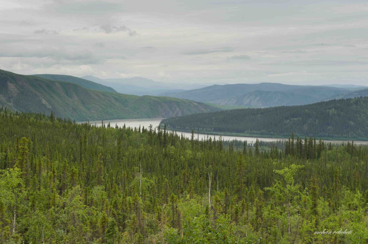 View of Yukon river valley from a steep hill, as it flows through Fort Hamlin Hills.
 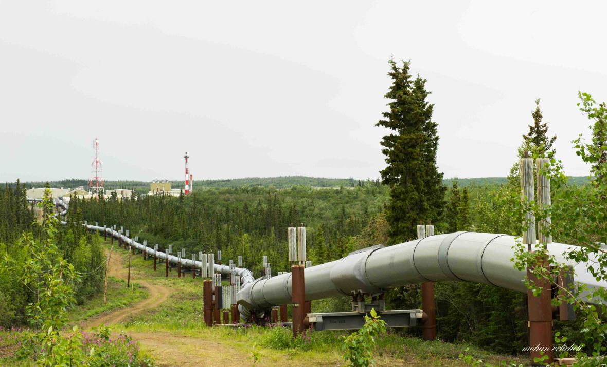 Pump station-6 (also an “Oil spill response base”).
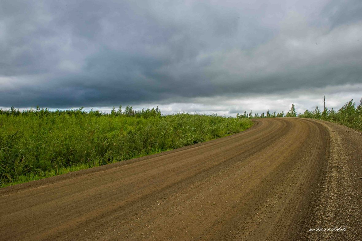
 The rain did not stop for the next 3 days.
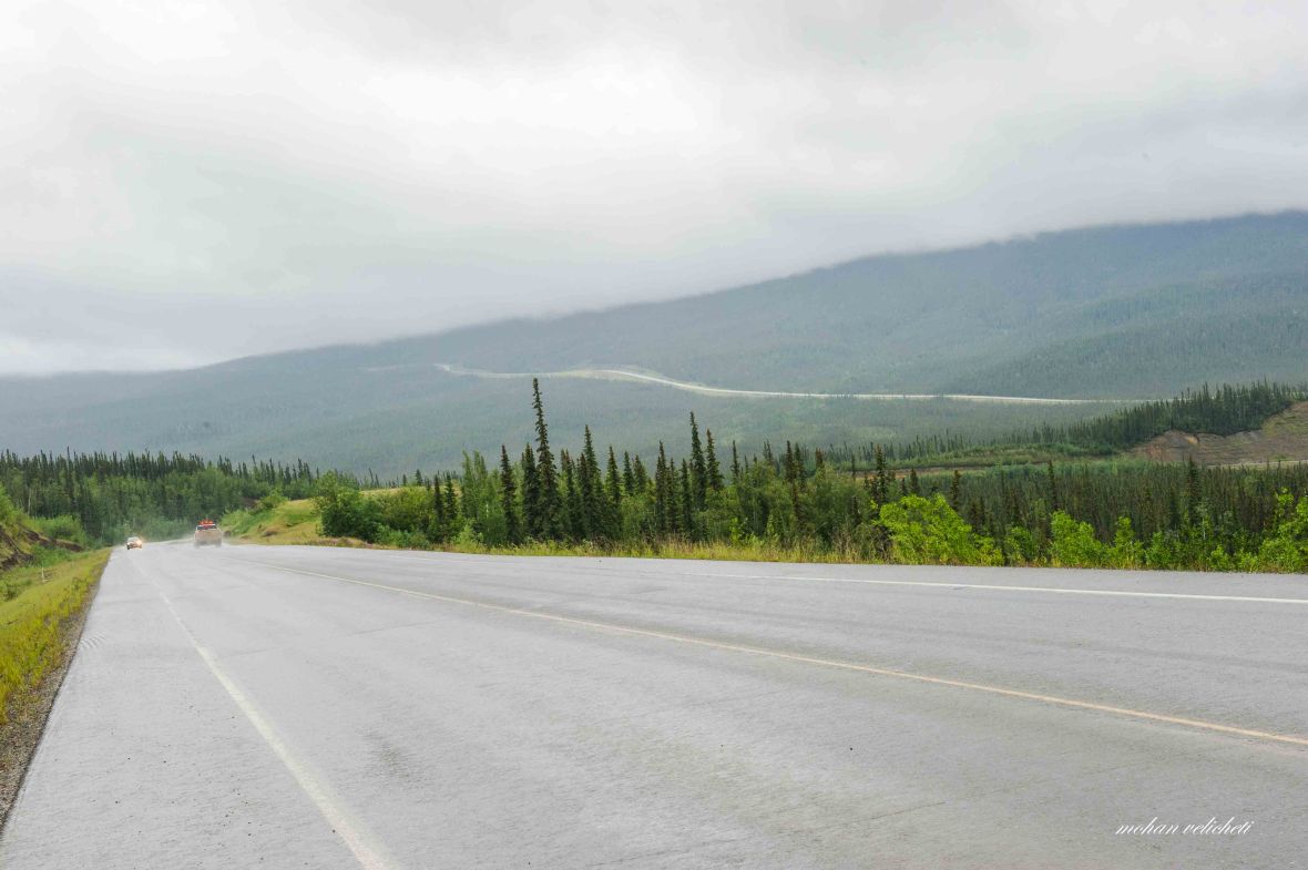 View of the short paved Dalton highway as it snakes up a hillside. With many 1 to 3 mile long steep slopes of 9% grades, with mud splashed all over me in rain, it had been a tough and long day.

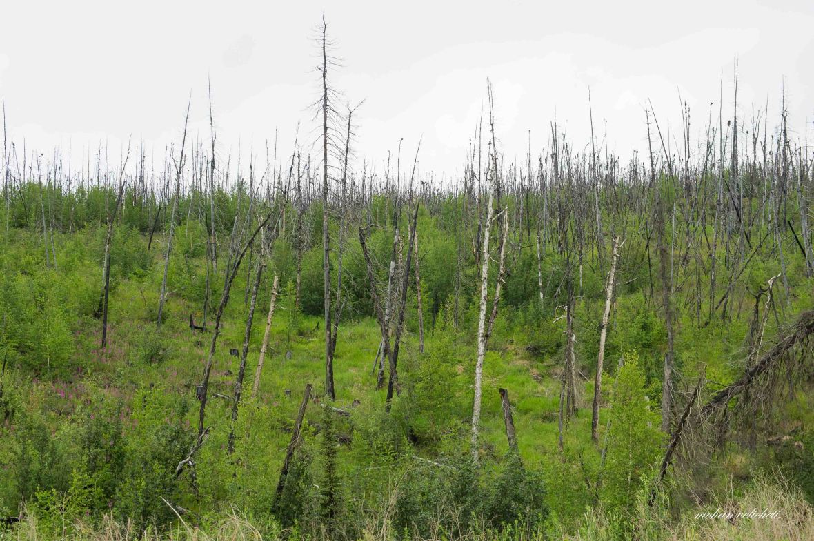 Forest burnt in recent years by lightning.
 Around here, at 2100 hours, i met Graham, a 67 year old motor biker. The words, care and gestures of this elderly gentleman had filled my heart as i rode the next few miles.
 The lady (originally from Connecticut but living in Anchorage) riding a fat bike from Livengood to Deadhorse. Here, i met on her first day of ride.
 Finally, end of Dalton highway, at midnight, shortly before Livengood.
A heavy truck passed by while i took selfies. Laughed at myself on thinking what the truck driver must have thought about a solo cyclist who is taking selfies at mid-night on this dusty road. From here on, the Dalton gave way to a smooth road, the Elliot highway, with a good shoulder. Happy with a nice road, and motivated to reach Shaun and Graham, rode for another 10 miles, past Livengood, to find them camping on the way side. With the sounds i made while pitching the tent, both of them woke up to check if it is not a bear, “Mohan?” “Yes.” It was 01:30 in the night, and still drizzling.
Day 9: Livengood to Fairbanks
Graham Griffiths was born in Ahmednagar in Maharashtra to missionary parents. He spent good number of years as a grown up in India. Of what i could make out, he lived few years in Bapatla (Andhra Pradesh) and worked as teacher in Ooty. On his facebook page, he claims that he is from Pune. On questioning, he said, “nobody knows Ahmednagar, but people know Pune.” He is riding all the way to Ushuaia, expecting to be there by christmas this year. “I will be there by christmas next year,” I said.
Before leaving that morning, he shared the address of the hostel, where he is going to stay in Fairbanks. With both me and Shaun targeting Fairbanks that night, 76 miles of ride, we agreed to see him at Sven’s place. After relishing the hot breakfast prepared by Shaun, we both hit the saddle. Soon, Shaun rolled on, while i washed the dirt on me, my bike and panniers, from previous day, in the Tolovana river. The informal campground on the bank of this river was where we actually wanted to stay the previous night. Few late sleepers still camped there. On mentioning that the water was red in colour, the couple from Seattle, in their RV, gave me a bottle of water.
The day continued in rain, with the road winding along the gentle to steep hill slopes that eventually led me into civilization near Fox, and further to Fairbanks at midnight. The happy people, chatting and drinking, in the kitchen cum common area at Sven’s place, welcomed me. With the absence of hostel staff at that hour, Graham gave me an orientation and picked a spot for me to camp under the trees in the garden. That night, i met the 5 guys from Czech republic who successfully climbed Denali without a guide, Erin- the motor biker, Nessa- the sober, kind hearted girl, and Nick- the bicyclist from Los Angeles, who all have educated me and influenced my thinking about the way I traveled in the days to come.

Mohan, thats a great travelogue or may be an Autobiography in the making.. What a great grit and guts you are made of. It feels great to know you, my friend. Your writing is so clean and crisp, I felt as though I am travelling along. Simply awesome. Keep going….All the best.
LikeLike